Down to earth data

 Georgina Smith(CIAT Southeast Asia)
In Lushoto, Tanzania, soil analysis will enable researchers to build maps which not only reflect the true complexity of soils within the landscape, but also put them in a position to give advice.
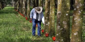
“Diversity.” It’s not often you get a one word answer from researchers, given the complexity of their work, but that is the answer soil scientist Rolf Sommer from CIAT gave when asked his impression of Lushoto district nestling in north-eastern Tanzania’s Usambara Mountains. Then he was whisked off into a meeting.
On first arriving in Lushoto town, after winding up the mountain range, it is not the first word that comes to mind. Unless, that is, you know a lot about soil. Forming part of the Eastern Arc Mountains which stretch between Tanzania and Kenya, this is a hotspot of biodiversity. She explains:
"What I’ve come to realize in my fieldwork over the last ten years,” says CIAT’s soil scientist Leigh Winowiecki, “is that landscapes are extremely varied. Lushoto is a prime example. Carbon per kilogram of soil can vary between 15 and 150 grams within one kilometer.”

women and men have formed groups to help each other adapt their farming practices. photo: georgina Smith (ciat)
Soil health is measured through indicators, such as organic carbon. This gauges inherent soil properties like texture or structure, which have an impact on what crops can grow and how well, and also the impact that farm management practices have on soil fertility.
The difference between 15 and 150 grams per kilometer shows two things: first that the soil is being used to grow a diversity of crops – vegetables, maize, beans, cassava, as well as forest cultivation; second, that cultivation methods are leading to both reduced soil organic carbon and soil erosion.
Sharp declines in soil organic carbon were measured in soil samples collected from 160 plots at two depths of 0-20 cm and 20-50cm. “Each soil sample we collected is linked to several other ecosystem health metrics,” said Winowiecki, including household surveys on land health, gender and socio-economic data. “Conventional scientific methods used to sample soils in varied landscapes are not adequate to capture the variability and assess the effects of land management,” she added. “The Land Degradation Surveillance Framework we designed provides a biophysical baseline of soil and land health metrics across the landscape so we can map variability better.”
The truth about dirt
That is what researchers call ground truthing. “It was actually believed that all the soil in Lushoto was one type,” she noted. “It turns out it’s more like four times that.” Soil analysis will enable researchers to build maps which not only reflect the true complexity of soils within the landscape, but also put them in a position to give advice.
Scholastica Morrison is a laboratory technician at the Selian Agricultural Research Institute (SARI), attached to CIAT. She makes her way over to a large machine and flicks some switches. After a few beeps, she disappears into an unassuming corner of her office and wheels in a trolley stacked full of petri dishes – colorful soil samples in every shade of brown.

Scholastica morrison, using state-of-the-art technology, a new near infaner spectrometer. Photo: georgina smith (CIAT)
“Every day I get new trays.” The magical robot, or Near Infrared (NIR) Spectrometer as it is less affectionately known, is faster, cheaper and more accurate than previous techniques for analyzing soil properties – now she can scan 200-300 soil samples a day instead of just 20.
“The scans tell me everything I need to know - all the nutrients required by the plant to grow - organic matter, calcium, phosphorous, nitrogen,” she says. Farmers send their samples to be tested at the lab because they get low yield, and they want to know how to improve their soil.
The results need interpreting - telling a farmer his soil has two percent of nitrogen in it does mean much. Instead, she advises farmers how to boost nitrogen - what fertilizer to use and when, or how much; which crops can be used to fix nitrogen in the soil.
In your own backyard
In the field, a team of field researchers, like Gladness Marthin from the Climate Change, Agriculture and Food Security Program, attached to SARI, work with farmers to teach them how to make simple soil profiles to determine soil properties, boost soil nutrients and reduce erosion.

community members learning how to diagnose soil properties before more detailed testing. Photo: georgina smith (ciat)
Identifying soil type and nutrient quantities - like nitrogen, phosphorous and potassium, all of which have an impact on plant growth - is like pinning down a moving target, not least because of more intense rainfall, which is moving fertile soil down the slopes, she said.
That is why empowering farmers with methods for testing their soil helps them realize that their cultivation practices are literally shaping their landscape. At the same time, it is helping them decide what to grow and where, more sustainably.
The complex nature of Lushoto’s ecosystems means multiple pieces of information about the landscape and how it is used are needed to build and map the bigger picture. What is the tree and shrub density? Is the soil infiltrated easily by water? What is the sociological content of land management? Diversity indeed.
For more information, download the following documents:
Soil Health Baseline Assessment
Biophysical Field Survey Update
Workshop report: Data Analysis and Adaptation Strategy Development Workshop
Georgina Smith is a Communications Specialist working for International Center for Tropical Agriculture (CIAT) based in Vietnam. She also helps with communication for CCAFS in the Southeast Asia region.