New tool simulates how climate change will affect our rangelands

 Cecilia Schubert, Communications Officer(CCAFS Theme Data & Tools)
Understanding how climate change will affect rangelands is crucial as millions of people around the world depend on them for food and income. Now an innovative tool, going by the name G-Range, can help us simulate future changes that in turn supports climate adaptation.
We usually turn to computer simulation tools when we want to find out what our future climate will look like. For rangelands, which are natural landscapes in the form of grasslands, shrublands, woodlands, wetlands, and deserts, such tools are either for a specific part of the world or very complex, alternatively too simple. Seeing as rangelands support the livelihoods of millions of people around the world and make up about 45 percent of the world's surface (excluding Antarctica), there is a definite need to find ways to simulate how climate change will affect these parts of the world as well.
Building on this need, scientists from Colorado State University have just put the final touches on an intersting tool called: G-Range. It's a tool that can simulate generalized changes in rangelands through time, with simulations that may span a few to thousands of years.
What can you do with the tool?
The tool is easy to use, and represents all global rangelands in a single simulation. It can simulate the growth of herbs, shrubs, and trees, and the change in the proportions of these plant types. The tool borrows from the Century model, which is used around the world to understand changes in soil chemistry.
With G-range you can track changes in carbon and nitrogen in the soil and plant parts. The death of plant parts and establishment, as well as deaths of whole plants can also be tracked, and you can in addition simulate fire in the model.
The tool is distributed with spatial data and settings that let the model simulate global rangelands. Users will likely want to make changes for their areas of interest, but the files that come with the tool will serve as a good starting point.
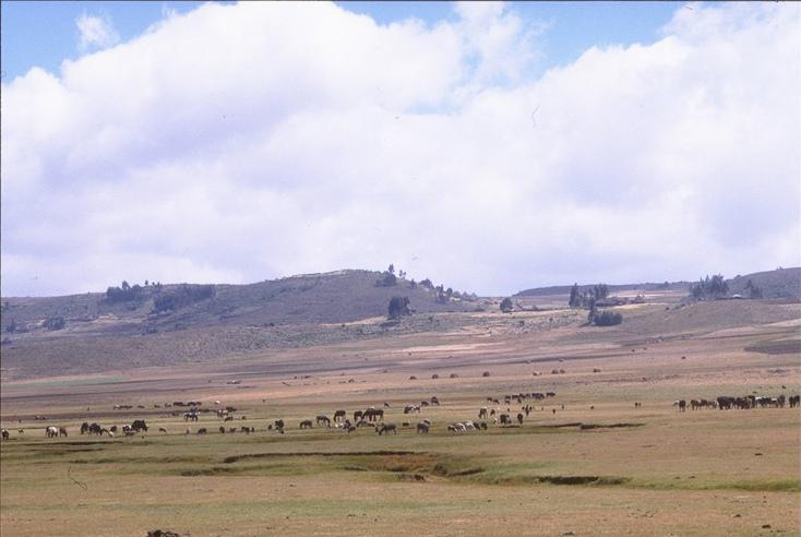
Ethiopian rangelanDs. Here Supporting livestock and herders. Photo:
Improving the G-Range tool step-by-step
When the model was first released to collaborators, the settings were only approximated. Improving the settings used in the model prior to its release to the public has been an important three step process:
First, scientists had to adjust settings and compare the responses to some real world data. Second, they had to document how changes in the individual settings changed outputs. This kind of work is called a sensitivity analysis. Lastly, they had to use the results from that work and other analyses to finalize the tool settings.
Randall Boone and Rich Conant, researchers at Colorado University and leading the G-range project, joined with Dr. Jason Sircely, post-doctoral scientist with the International Livestock Research Institute (ILRI) and at the Natural Resource Ecology Laboratory, to conduct the sensitivity analyses. In this work, the agreement between model output and published spatial data was of most interest. For the report they looked at 2006, included eleven global surfaces from various sources, such as the soil surface temperature, water in the soil and available to plants, and the vegetation grown.
These data either came from very well established modeling efforts or from authors reporting research results. A program was written that made comparisons between these surfaces and model output, preparing spreadsheet reports. The team then ran G-Range several hundred times while reducing differences between model output and the spatial surfaces, yielding fit that is reported in Table 2 (page 6-8) and Table 3 (pages 9-10), found in the report: Adjustment and Sensitivity Analyses of a Beta Global Rangeland Model.
Then for about 50 different settings in G-Range scientists varied the value used across seven levels spanning the original value. For example, the model includes a multiplier changing the effect of CO2 concentration on plants; plants use CO2 in photosynthesis, and so changing that value can change rangeland productivity.
The base value was 0.8, and so we ran seven simulations with the value spanning from 0.6 to 1.0. For each of the settings tested, a page was prepared that summarized what the setting means, the values tested, a summary of the effects on model outputs, and if the model should be changed in response to the results. This is what the different tests for the G-Range tool settings look like in the report:
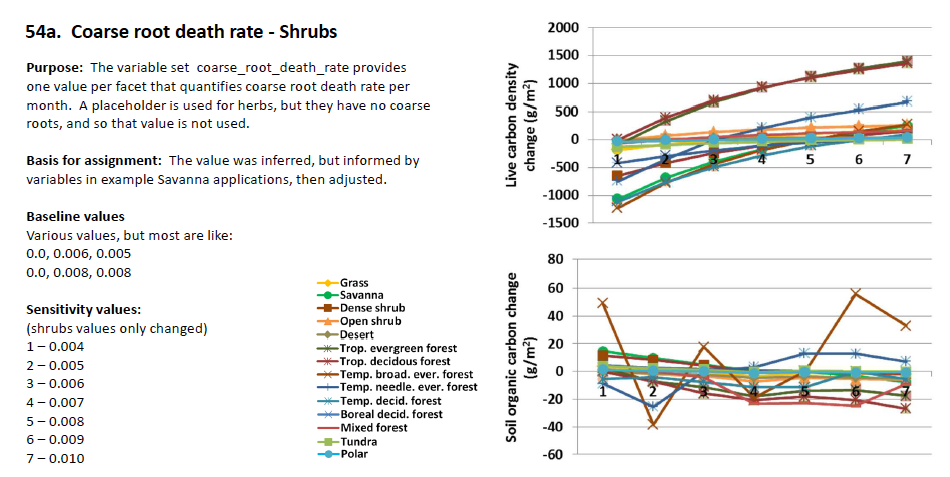
Above image: Testing the variable set coarse root death rate on Shrubs.
The CGIAR Research Program on Climate Change, Agriculture and Food Security (CCAFS) and the International Livestock Research Institute provided support to this tool.
Download the G-range tool and simulate how climate change will impact and affect rangelands globally.
Learn more about the G-range project:
- Report: Adjustment and Sensitivity Analyses of a Beta Global Rangeland Model
- G-Range project page on our web site: Global Rangeland Model Development and Testing
- Poster: G-Range: An intermediate complexity model for simulating and forecasting ecosystem dynamics and ecosystem services in grazing lands at scales from local to global
- G-range web site
Story put together by Cecilia Schubert, Communications Officer at CCAFS Data & Tools team, together with Randall Boone and Rich Conant, Research Scientists at the Natural Resource Ecology Laboratory and faculty in the Department of Ecosystem Science and Sustainability at Colorado State University.
This blog is part of a newly launched series highlighting CCAFS many open access data platforms and climate and agriculture research tools. All related Data & Tools stories can be found here.