South Asia: the Challenge
South Asia is 2.4% of the world’s land surface area and it is a home to 23% of the world's population, making it both the most populous and the most densely populated geographical region in the world.
The region has shown tremendous progress in last four decades in food production and availability, yet 1/4 of the world’s hungry and 40% of the world’s malnourished children and women live here.
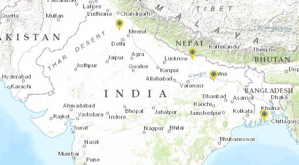
The region, comprising of Pakistan, India, Nepal, Bhutan, Bangladesh, Sri Lanka and Maldives, possesses diverse soils, climates, physiography and other natural resources. Much of the region comprises a peninsula in south-central Asia, delineated by the Himalayas on the north, the Hindu Kush in the west, and the Arakanese in the east, and which extends southward into the Indian Ocean with the Arabian Sea to the southwest and the Bay of Bengal to the southeast.

Click to explore CCAFS sites in South Asia
The climate of this vast region varies from tropical monsoon in the south to temperate in the north. Monsoons have a great impact on climate and consequently on agricultural systems. Rice-wheat cropping pattern predominates in the fertile plains of the region, aquaculture based farming in the coastal areas and mixed farming systems in the highlands (such as cereals, legumes, tubers, vegetables, fodder trees, orchards and livestock) along with several intermediate forms depending on the amount of rainfall and altitudinal gradient.
Spanning parts of Pakistan, India, Nepal and Bangladesh, the Indo-Gangetic Plain (IGP) of South Asia is a food basket of the region. The IGP is densely populated, home to 500 million people, about 10% of South Asia’s population, and is characterized by fertile soils, favourable climate, abundant surface and groundwater, and its rice-wheat systems based rural livelihoods that provide food security for millions of people in the region.
Millions of people in South Asia are vulnerable to climate change because of depleting glaciers, increasing coastal erosion, frequent floods, droughts, and periods of higher temperatures associated with global warming. High population density, high dependency of agriculture on monsoons, and extreme poverty add to the woe. Densely populated low-lying areas of mega deltas are at severe risk. Sea-level rise is the most obvious climate-related impact in coastal areas. Producing enough food for the increasing demand against the background of reducing resources in a changing climate scenario, while also minimizing further environmental degradation, will be a challenging task.
About our work
- Understanding impacts and adaptation strategies in key crops of the region
- Climate analogue linked germplasm characterization, evaluation and conservation
- Farmer to farmer adaptation learning across climate analogue sites
- Analysis of current policies and institutions in promoting climate smart agriculture
- Prioritizing key adaptation/mitigation interventions in agriculture at different levels
- Documenting indigenous knowledge on adaptation at the farm level
- Understanding the impact of climatic variables on food grain price, demand and supply at different scales
- Weather forecasts based crop yield forecasting
- Estimating baseline emissions from CCAFS sites
- Developing MRV guidelines in rice-based cropping systems
- Building climate-smart villages by piloting a range of technological and institutional interventions to promote resilience, adaptation and mitigation
- Strengthening regional engagement and communication with stakeholders through a Climate Smart Agriculture Learning Platform and Science-Policy-People Interface on Climate Change, Agriculture and Food Security
- Strengthening capacity of the rural women on climate change and agriculture
- Developing regional databases for enhanced assessment of vulnerabilities to climate change