Commune-level Climate-Smart Maps and Adaptation Plans (CS-MAP) for the Transforming Farming System under Climate Change project
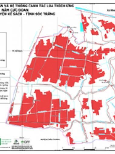
To increase the effectiveness of the risk management and adaptation strategies, the Climate-Smart Mapping and Adaptation Planning (CS-MAP) methodology has been downscaled to the commune level. Through the Transforming Farming System under Climate Change (TFCC), CS-MAP is currently being used to identify areas of rice production that are not adaptable in the current farming system and propose suitable farming systems. The Department of Crop Production of Vietnam and the National Agricultural Extension Center, together with CCAFS Southeast Asia, International Center for Tropical Agriculture, and International Rice Research Institute, has implemented the TFCC project in three selected communes in MRD, such as Hoa Chanh (U Minh Thuong district, Kien Giang province), An My (Ke Sach district, Soc Trang province), and Tan Phuoc (Go Cong Dong district, Tien Giang province).
Citación
CCAFS SEA, DCP, NAEC, CIAT, IRRI. 2020. Commune-level Climate-Smart Maps and Adaptation Plans (CS-MAP) for the Transforming Farming System under Climate Change project. Hanoi, Vietnam: CGIAR Research Program on Climate Change, Agriculture and Food Security (CCAFS).