Putting climate forecasts into farmers' hands
Guest blog by Ousmane Ndiaye, Senegal National Meteorological Agency.
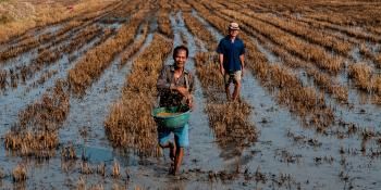
It was a hot June day in Kaffrine, Senegal. As usual at this time of the year all eyes were looking toward the sky, expecting a good rainy season in a country where more than 80% of the activities rely on rainfall. Farmers were still wondering when the first rain would occur, and whether the rainy season would be able to sustain their crops. As climate grows increasingly unpredictable, seasonal forecasts will be essential to help farmers plan and reduce the impacts of weather variability. As part of ongoing work on managing climate risk, researchers from the CGIAR Climate program (CCAFS), have joined with climatologists, NGO workers, and agricultural advisers to take on the challenge of empowering farmers to better understand and use probabilistic seasonal climate information.
On 4-5 June 2011, the experts met with 30 farmers (including 10 women) from 6 villages around Kaffrine, located in the peanut-growing region of Senegal. The group included climatologists from the National Meteorological Agency, volunteers from World Vision, agricultural advisers from the national agency for agricultural and rural advice (ANCAR), an agronomist from Ministry of agriculture, an agro-economist from the national agricultural research institute (ISRA) and Jim Hansen, CCAFS Theme Leader on Adaptation through Managing Climate Risk.
After welcoming words by the local prefet (administrative authority), I started by acknowledging farmers’ traditional knowledge of climate, based on decades of experience. I asked them about their indicators of the coming season or an imminent rain. One farmer told us “we know the start of the rainy season from the wind changing direction”. I haven’t seen a more concise way of depicting the monsoon, which is a change of the wind direction from northeasterlies (harmattan) to southwesterlies (monsoon). Another one said a sign of an imminent rain is when very dark clouds suddenly turn to white. This agrees with precipitable Squall Lines, announced by low, dark strato-cumulus clouds, followed by white convective cumulo-nimbus clouds formed by ice.
After listening to all of them with care and respect, I told them we are using some of these indicators too. I went through the ones I could relate to known phenomenon, noting “our only difference is we use better tools, better observing system and more systemized reporting”. I mentioned observing through satellites, our network of sharing information around the world, our capacity of storing and analyzing data using computers. You could see their readiness to listen in their attentive eyes.
I continued to explain the basis of seasonal forecasting. “When it is hot, why do people go to the beach?” I asked. They responded at unison because sea breeze brings fresher air. I took it further: “Then tell me why. Is it not the same sun that heats both land and ocean? Why then does the ocean get cooler in summer?” I explained that ocean has better memory of the past compare to the continent. The ocean remembers the heat of the past days and weeks. That’s why, on a very hot day you go to the beach to benefit from ocean memory of the past weeks. Same thing when it is cold, the ocean still remembers warm days. This is the basis of seasonal forecasting: using ocean heat memory.

We use satellites to monitor ocean temperature throughout the world, and use computers to deduce the likelihood of rain in Senegal. As rain comes from clouds, clouds come from water, and water from the ocean, you can see how ocean temperature can control rain. Upon hearing this, a skeptical smile appeared on some. After pointing out the difficulty of estimating exactly how much it will rain, I asked whether their traditional indicators are 100% accurate; they all say no. One farmer commented, “Only God knows what is happening 100% in the future”. They understood the uncertainties. By the end of the first session, I had built trust by connecting our common indicators, established the basis for seasonal forecasting, and introduced its probabilistic nature.
In the afternoon, the experts went to administer questionnaires in six villages around Kaffrine. The idea was to find farmers in their local environment and document their livelihood and their needs for climate information -- in what format and through which medium.
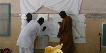
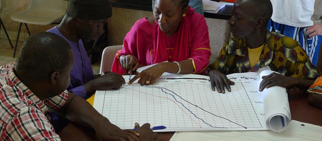
In the second day of the workshop, we divided the farmers into four groups. Each group was given a graph of probability of exceedance for the climatological distribution and a hypothetical forecast. I told them, “Let’s assume this is the forecast of a given year. Tell us what would you do differently than usual. What concrete actions would you take in your farming strategy, and why?” The farmers agreed that climate forecasts can make a difference in their strategies, with different strategies proposed for dry and wet forecasts. It gave me further confidence that they did understand how to interpret the forecast.
In the discussions afterwards, I noted how farmers differentiate between a good rainy season (as was 2010) and a good crop season (as was 2008). As a result, they prefer a forecast in term of number of rainy days rather than the season rainfall total, and they asked for forecasts of the distribution of rain within the season.
The workshop ended with a promise to farmers that we would share with them the actual 2011 seasonal forecast (which we did the following week); to keep in touch; and through CCAFS to work on the new products they asked for including forecasts of onset of the rainy season, extreme events, and dry and wet spells. We plan to visit them at least two times during the current season and will have another workshop to evaluate the rainy season.