Climate-Smart MAPs to aid in rice production at the Mekong River Delta of Vietnam
 Renz Louie Celeridad(World Agroforestry Centre)
Climate-Smart Maps and Adaptation Plans is an approach of risk mapping and adaptation planning to mitigate the risks posed by climate change and other natural disasters.
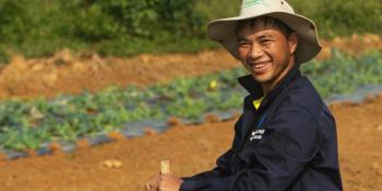
In 2016, an El Niño-Southern Oscillation (ENSO) hit Vietnam, especially the Mekong River Delta (MRD), where more than 90% of the country’s rice export is annually produced. The regular flooding and salinity intrusion in the area is time to time further worsened by ENSO, severely affecting the agricultural sector of the country. As assessed by CGIAR Centers, preparations to cope with the 2016 ENSO were either lacking or not informed by the early warnings given by the government.
As a response, the Vietnamese government and the CGIAR Research Program on Climate Change, Agriculture and Food Security in Southeast Asia (CCAFS SEA) partnered to develop and implement climate-related risks maps and adaptation plans or Climate-Smart Maps and Adaptation Plans (CS MAP).
CS MAP is a participatory approach that engages experts from the national and local levels to accomplish the following:
- Identify climate-related risks using science evidence and local knowledge;
- Determine potential affected areas and their risk levels;
- Improve proposed adaptive measures; and
- Develop integrated adaptation plans for rice production from regional to provincial levels.
CS MAP serves as a guide for provinces to help them develop their own risk maps and adaptive plans, which cater to their respective local contexts. The CS MAP covered on this study is specifically for rice production but the adaptation options can be applied for aquaculture, livestock, and other crops. Currently, the CS MAP approach is being developed and implemented in MRD’s provinces.
How was the CS MAP developed and implemented?
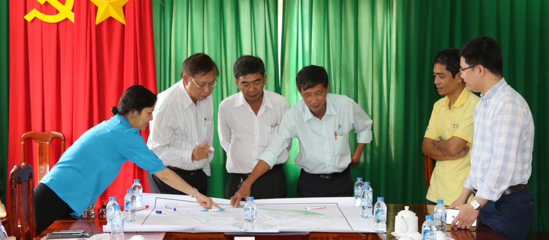
CCAFS SEA developed and initially piloted the CS MAP in early 2016 in Bac Lieu province based on the key informants’ general understanding on flood and salinity risks, local knowledge, and methodological gaps. The key informants invited are experts on hydrological and cropping systems.
The findings on the initial run of CS MAP then served as the foundations that would be implemented for all 13 MRD’s provinces. They were presented to experts and officials from the government’s Department of Crop Protection (DCP), Ministry of Agriculture and Rural Development (MARD). It was agreed that:
- CS MAP must be developed through a multi-disciplinary collaboration, which involves specifically the Hydrology Management Office (HMO) and Crop Production Office (CPO), as well as research institutes and universities and international agencies.
- There are four risk levels:
- High risk or possible loss of more than 70% of rice production
- Medium risk or possible loss of 30% - 70% of rice production
- Low risk or possible loss of less than 30% of rice production
- Not affected or no impact on rice production
- In the MRD, drought and salinity intrusion can be considered a single risk because those two phenomena are results of an extreme event.
The provinces have developed their own risk maps and adaptation plans, which were then integrated in the regional context because rice production of a province is tightly influenced by plans and actions of others. Any changes, therefore, in rice sowing and planting calendar of one province should not conflict with those of nearby provinces.
Recommendations on risk maps and adaptive plans
During a multi-stakeholder dialogue in July 2017, more than 120 participants from the provincial branches of the Department of Agriculture and Rural Development (DARD), researchers, and experts convened and recommended the following:
- Sharing of resources and investments, among others, for the benefit of the whole region.
- Managing cross-provincial interventions, which can be integrated into the South-West Steering Committee, a Vietnamese institution with a mandate relevant with the issues at hand.
- Building networks among the government, private sector, farming sector, and the scientific community to sustain rice production in MRD.
- Localizing risk maps, i.e., considering local-specific factors such as acid sulphate soil, drainage and irrigation conditions, among others.
- Predicting future market prices to help in the planning and decision-making processes.
- Implementing new cropping calendar and system that consider structural measures, water-saving technologies, and policies, among others.
A fully-developed CS MAP is expected to help provinces to cope with natural disasters and sustain their rice yields. It can also be adopted to other crops, aquaculture, and livestock. Moreover, the CS MAP can be applied in other purposes such as poverty mapping, disaster relief and operations.
Download the working paper: Son, N.H., Yen B.T., and Sebastian L.S. 2018. Development of Climate-Related Risk Maps and Adaptation Plans (Climate Smart MAP) for Rice Production in Vietnam’s Mekong River Delta. CCAFS Working Paper no. 220. Wageningen, the Netherlands: CGIAR Research Program on Climate Change, Agriculture and Food Security (CCAFS). Available online at: www.ccafs.cgiar.org
Read more:
- CCAFS blog: Learning from Vietnam’s experience on Climate-Smart MAP - South-South Collaboration
- CCAFS blog: Mapping the problems and solutions: Implementing climate-smart agriculture actions in Mekong River Delta
- CCAFS blog: The drought and salinity intrusion in the Mekong River Delta of Vietnam
Renz Louie Celeridad is the junior communications specialist for the World Agroforestry Centre Philippines. He also works as communication consultant for CCAFS SEA program.