Improving availability, access to and use of climate information in Ethiopia

Workshop for developing expertise in data and digital solutions to support smallholder farmers in Ethiopia.
Climate change is threatening farmers’ livelihoods in Ethiopia. Climate information services are a critical component of climate adaptation in the country.
Making climate information available to policymakers at the national level as well as to smallholder farmers to inform their decision-making is a key goal of the Ethiopian government and its partners.
Recently, a workshop was organized to introduce the IRI Data Library and NMA Maprooms, a powerful online data repository and analysis tools that improve the availability of, access to, and use of climate information in Ethiopia.
The workshop was part of a greater effort to build capacity amongst partner organizations’ staff to develop expertise in data and digital solutions to support smallholder farmers.
Enhancing national climate services
The International Research Institute for Climate and Society (IRI) developed the data library through the Enhancing National Climate Services (ENACTS) initiative.
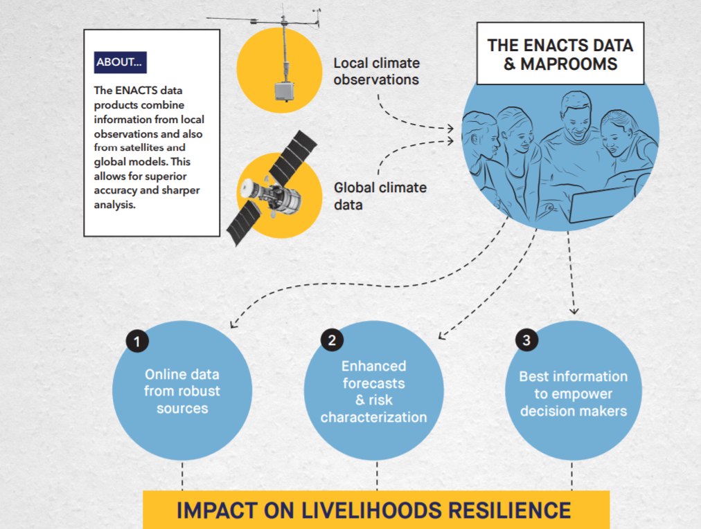
ENACTS is a multi-faceted, multi-country initiative, designed to bring climate knowledge into national decision-making through a three-pronged approach: improving availability of, access to, and use of targeted climate information.
ENACTS: Transforming climate-sensitive decisions in Ethiopia flyer
The IRI Data Library, which has been accessed by users in nearly every country in the world, allows users to view, analyze, and download climate-related data. This workshop gave participants an overview of how they can use ENACTS tools such as the IRI Data Library to address their challenges with data quality, dataset interoperability, and accessibility.
Maprooms
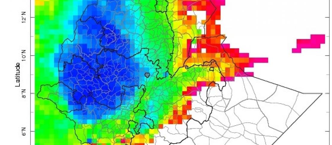
One key feature of the IRI Data Library is the ability for users to develop geographic-specific maprooms, which are a collection of maps and other visual data representations that monitor climate and societal conditions both past and present.
For five years, IRI has partnered with the Ethiopia National Meteorological Agency (NMA) to develop the NMA Maproom, which is designed to address a common challenge of providing targeted climate information to non-technical decision-makers in climate-sensitive sectors so they can make informed analyses and decisions that lead to climate solutions, reduced disaster risk, and increase resilience to climate shocks.
Access to data
Several workshop participants raised the challenge of accessing data only on request or through a memorandum of understanding with data-generating partners. Participants were pleased to see that NMA has made an array of climate information products available through its online maprooms, which could be accessed by anybody with internet from anywhere.
The NMA Maproom adds context to data. Workshop participants learned that the data in NMA Maproom is linked to maps, figures, and tools for visualizing, querying, and accessing information products. The Maprooms' user-friendly interface and glossary enable non-technical users to manipulate and analyze this data with relatively little training. Each map and figure is linked to the raw data in the IRI Data Library where technical experts can also engage on a deeper level.
With the right expertise you can create as many Maprooms as you want and that is the beauty of this IRI Data Library.”
Tufa Dinku, Climate and Environmental Monitoring Research Scientist, IRI
Workshop participants' recommendations for the future
The NMA Maproom can enhance Ethiopia’s development, but only if a critical mass of decision-makers know about it and use it. The workshop aimed to raise awareness of the tool with the expectation that the participants would train their peers.
Tufa Dinku said that these workshops seek to involve users in the development of the tool itself, and feedback from users will inform the development of the product.
Inputs from experts at the Ethiopian Institute of Agricultural Research (EIAR) can strengthen the infrastructure of the NMA Maproom, and a collaboration between NMA and EIAR will be vital to draw recommendations and provide services.
Workshop participants offered feedback on multiple methods for increasing the utility of the NMA Maproom, namely offering training at high schools and universities so that students can utilize the Maprooms for research projects and Ph.D. dissertations, with the added benefit of encouraging young researchers to pursue careers in climate-related fields.

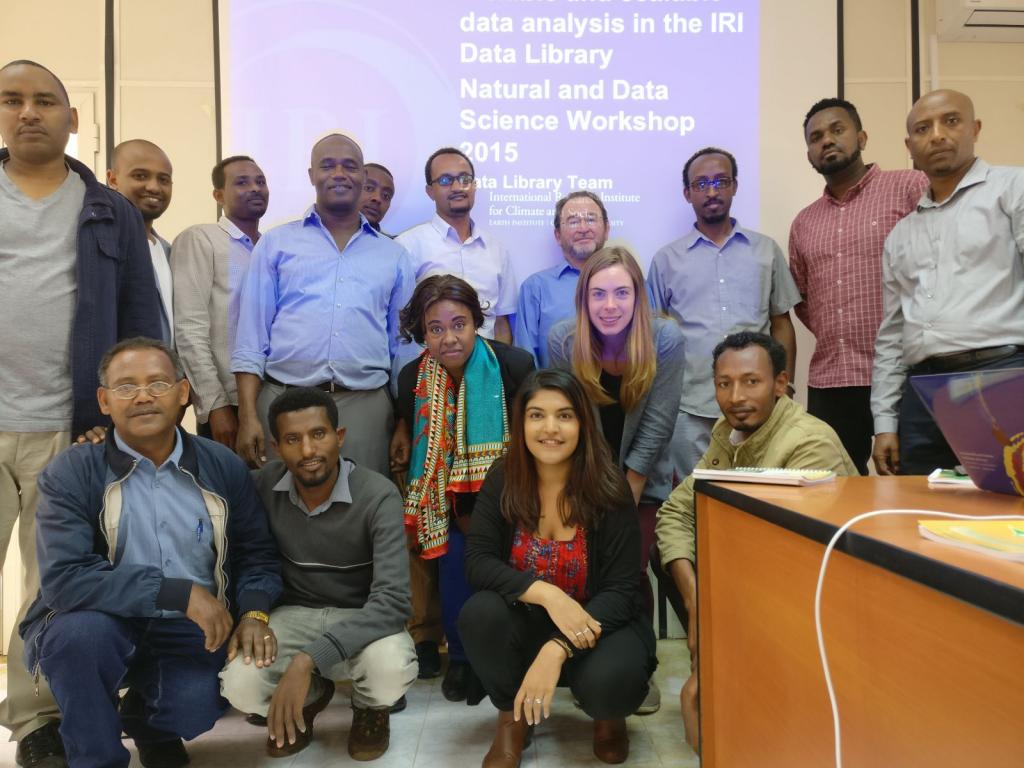
Workshop participants. Photo: R. Pattni (IRI/CCAFS)
As the workshop wrapped up, participants agreed that while NMA Maproom is useful for providing climate information to non-technical decision makers in agriculture, water, and public health, it has a lot of potential beyond its current capabilities. Several workshop participants brainstormed how the NMA Maproom could be used to develop an integrated agriculture advisory package for different value chains with the possible integration of market data for smallholder farmers.
As NMA’s Ethiopian userbase grows, it will be interesting to see how users turn this platform of innovation into digital solutions to support Ethiopian development.
Read more:
- Website: IRI Data Library
- Blog: Partnering with national meteorological services to support farmers in Africa
The workshop was organized by the International Research Institute for Climate and Society (IRI) in partnership with the Ethiopian Institute of Agricultural Research (EIAR), the CGIAR Research Program on Climate Change, Agriculture and Food Security (CCAFS), and the International Center for Tropical Agriculture (CIAT).
Ravina Pattni and Kelly Ward are CGIAR, CCAFS East Africa Graduate Fellows and Columbia University graduate students working with IRI on a five-year project called Adapting Agriculture to Climate Today, for Tomorrow (ACToday), of which CCAFS and the CGIAR are key partners.


