Regional Climate-Smart Maps and Adaptation Plans (CS MAP) for Mekong River Delta, Vietnam
Publiés
by
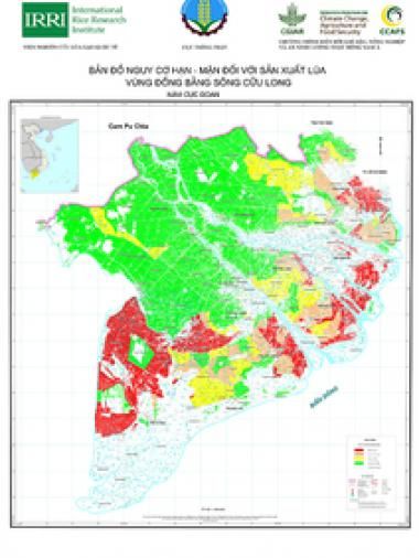
Updated regional maps of drought and salinity intrusion risks (both for normal and extreme years) for rice production areas in the Mekong River Delta. The maps are products of the collaborative work of the Department of Crop Production - Vietnam's Ministry of Agriculture and Rural Development and CCAFS Southeast Asia in 2020.
Citation
CCAFS SEA. 2020. Regional Climate-Smart Maps and Adaptation Plans (CS MAP) for Mekong River Delta, Vietnam. Hanoi, Vietnam: CGIAR Research Program on Climate Change, Agriculture and Food Security (CCAFS).