CCAFS showcases its Maproom project at the University of Rwanda Scientific Conference Week 2017
 Tabitha Muchaba(CCAFS East Africa)
It is now feasible to provide climate information services that are actionable at the local scale of agricultural decision-making.
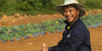
The impact of climate change on Rwanda’s agriculture and sustainable development is a continuous challenge. The growing concern has yielded much research on agricultural transformation from subsistence agriculture to intensive, market-oriented agriculture. This was one of the recurring themes of the Scientific Conference Week that was held from 14-16 June 2017 in Kigali, Rwanda. The conference was organized by the University of Rwanda in partnership with UR Sweden Program, Rwanda Development Board and the International Institute of Tropical Agriculture (IITA). Under the overall theme ‘Rebranding Research for Sustainable Development’ the two-day conference brought together various stakeholders from academia and industry to share their knowledge, innovation and expertise.
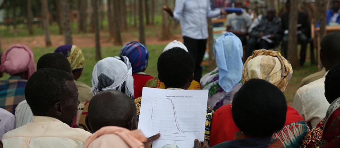
The conference created a platform to showcase how the Enhancing National Climate Services initiative (ENACTS) implemented by the International Research Institute for Climate and Society (IRI) has filled the 15-year gap in Rwanda’s historical meteorological records. Through ENACTS, the CGIAR Research Program on Climate Change, Agriculture and Food Security (CCAFS) works with International Center for Tropical Agriculture (CIAT) and other partners to support Rwanda’s National Meteorological Services (NMS) to fill data gaps and to provide high quality climate information. As a result, it is now feasible to provide climate information services that are actionable at the local scale of agricultural decision-making. The ENACTS approach overcomes data gaps by blending NMS station data with satellite and other proxy data, to produce moderately high-resolution (roughly 4 km grid) historical gridded data (more than 30 years for rainfall, 50 years for temperature) and access to information is improved through the development of online “Maproom” tools derived from the historic data sets, integrated into the NMS web pages.
The Maproom is a collection of maps and other figures that are used to monitor past and present climate and societal conditions. The maps and figures can be manipulated and linked to the original data and users can choose which datasets are particularly useful for monitoring current conditions.
The Maproom also features a Climate Data Library - an online data repository and analysis tool that allows user’s to view, analyze, and download hundreds of terabytes of climate-related data. The user can also monitor present climate conditions with maps and analyses and also create visual representations of data, including animations. This data can then be downloaded in a variety of commonly used formats including GIS-compatible formats. All this can be done by the user through a standard web browser for free.
The booth was visited by participants from academia and industry frommore than nineteen countries, keen to learn more about the maproom and the climate data library.
See pictures from the exhibition here:
The Rwanda Maproom is accessible via http://maproom.meteorwanda.gov.rw/maproom/index.html
This initiative is part of the USAID funded Rwanda Climate Services for Agriculture project. For more information regarding the project contact Desire Kagabo, the CCAFS Rwanda Climate Services for Agriculture Project Coordinator based at the International Center for Tropical Agriculture (CIAT), Kigali, Rwanda d.kagabo@cgiar.org
Read more:
- Project factsheet: Rwanda Climate Services for Agriculture
- Blog: PICSA training of trainers: strengthening national and local capacity for climate services for agriculture in Rwanda
Tabitha Muchaba works for CCAFS East Africa