Climate Risk Informed Crop Calendar developed for the 13 provinces in the Mekong River Delta, Vietnam

 Eisen Bernard Bernardo(International Rice Research Institute)
In a recent conference, strategies for crop production improvement in the Mekong River Delta, including Climate-Smart Maps and Adaptation Plans for rice, were presented to key stakeholders by Vietnam's Ministry of Agriculture and Rural Development.
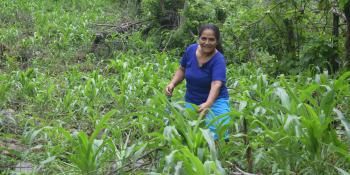
Dubbed the ‘rice basket’ of Vietnam, the Mekong River Delta (MRD) contributes 56% of the total domestic rice production and more than 90% of the country’s rice export. With over 1.7 million hectares of land (more than half of the total arable land in the region) used for rice, almost 80% of the MRD's 17 million people are dependent on rice production for their livelihoods.
To assess the performance of the previous summer-autumn cropping season and to present strategies for the coming autumn-winter crop production in the Southeast and MRD regions, Vietnam's Ministry of Agriculture and Rural Development (MARD) organized a conference in Tay Ninh province on 20 July 2018.
MARD’s Department of Crop Production (DCP) presented the achievements and challenges, and lessons learned and recommendations from the previous cropping season and also laid down the implementation plan for this year’s autumn-winter season. To elaborate on the production strategies and to provide further guidance, various MARD-attached agencies presented reports and forecasts for different aspects of production, such as: water resources and irrigation, pests and diseases, domestic and export markets, and hydro-meteorology.
One of the highlights of the conference was the launching of the Climate-Smart Maps and Adaptation Plans (CS MAP) for promoting sustainable rice production in the MRD developed by the DCP and provincial Departments of Agriculture and Rural Development (DARDs). Led by MARD Vice Minister Le Quoc Doanh, risk maps for flooding, drought and salinity intrusion, and the corresponding monthly adaptive cropping schedule, both for normal and severe years, were unveiled.
In his message, Vice Minister Doanh emphasized that “the proposed shifting of planting dates is very specific and helpful for harmonizing the fragmented cropping calendar in the region. It will also help in consolidating human resources for a specific time and in reducing other related costs. CS MAP can help DCP to better manage and guide the rice production of the 13 provinces.”
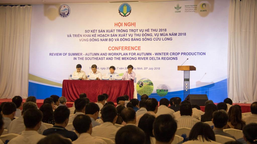 MARD Vice Minister Le Quoc Doanh (3rd from left) led the presentation of the strategies for crop production improvement in the south of Vietnam. Photo: Leo Sebastian (CCAFS SEA)
CS MAP, a participatory approach developed by the CGIAR Research Program on Climate Change, Agriculture and Food Security (CCAFS), engages experts from the national and local levels to:
- identify climate-related risks;
- determine potential affected areas and their risk levels using technical, infrastructure and topographic data, and local knowledge;
- assess and improve proposed adaptive measures;
- and develop integrated adaptation plans for rice production from regional to provincial levels.
Maps of flooding and salinity intrusion risks were developed by integrating scientific evidence provided by researchers and experts with local knowledge of stakeholders on topography, infrastructure, hydrological management schemes, and land use plans. Based on the risk maps, adaptive rice production calendars for moderate intensity and duration (normal year) and extreme intensity and prolonged duration (severe year) were generated. Through a series of consultations with provincial and regional stakeholders, the cropping schedules were proposed, not only to address various climate-related risks, but also to ensure sharing of resources and harmonization of policies concerning water, labor, infrastructure, and information.
The risk-prone areas of 12 provinces (except Ca Mau) were identified. In line with the MARD Decision No. 1915/QĐ-BNN-KH signed last May on development of rice production in the MRD up to 2025 and the vision for 2030 under climate change, the adaptation plans, particularly the proposed cropping schedule, developed using CS MAP, are advised to be adopted in every MRD province.
However, to make CS MAP more useful and applicable, Vice Minister Doanh encouraged DCP, together with provincial DARDs and CCAFS, to continue to downscale the maps to provide a higher level of detail for district and commune users. To actually implement outputs of CS MAP, he assigned DCP to work with concerned DARDs to implement the recommended crop calendar as part of the Vietnam Sustainable Agricultural Transformation project activities. This conclusion was officially issued by MARD in the announcement No. 6194/TB-BNN-VP.
Read more:
- News update: Climate-Smart MAPs to aid in rice production at the Mekong River Delta of Vietnam
- News update: An integrated system for real-time monitoring of rice production and climate risks
- Blog: Mapping the problems and solutions: Implementing climate-smart agriculture actions in Mekong River Delta
The conference was hosted by the Provincial People Committee of Tay Ninh, with support from the CGIAR Research Program on Climate Change, Agriculture and Food Security in Southeast Asia (CCAFS SEA). It was attended by more than 200 officials from MARD, provincial DARDs, and MARD's affiliate agencies; representatives from regional hydro-meteorological stations; leaders of Tay Ninh province; experts from national and international research organizations; and private sector actors.
Eisen Bernardo is the Senior Communication Specialist of CCAFS Southeast Asia.